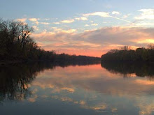
When the Wisconsin Glacier melted 14,000 years ago, part of the meltwaters formed the proglacial Lake Maumee, the ancestor to Lake Erie. Eventually the meltwaters overtopped a glacial moraine located near Fort Wayne, Indiana, and catastrophically drained southwestward in the Maumee Torrent. The torrent carved the wide alluvial valley that the Wabash flows through today.
The name "Wabash" is an English spelling of the French name for the river, "Ouabache." French traders named the river after the Miami Indian word for the river, waapaahšiiki, meaning "it shines white". The Miami name reflected the clarity of the river in Huntington County, Indiana where the river bottom is limestone.[1] This is a historical oddity since today the river bottom is no longer visible due to water pollution and agricultural siltation.
The Wabash was mapped and named by French explorers to the Mississippi, including the sections now known as the Ohio River[2] Although the Wabash is today considered a tributary of the Ohio, it was considered the other way around until the mid-18th century.[3] This is because the French traders traveled North and South from Canada to the Gulf of Mexico, and the Ohio River was not considered an important trade route until France and Great Britain began fighting for control over it, sparking the French and Indian War.[4]. For 200 years, from the mid-1600s into the 1800s, the Wabash was a major trading route, linking Canada, Quebec and the Great Lakes to the Mississippi River and Louisiana.
Three notable battles in U.S. history: the Battle of Vincennes (1779), St. Clair's Defeat (1791) and the Battle of Tippecanoe (1811), were fought near the Wabash; the last two have each been referred to as the "Battle of the Wabash".
A 329-acre (133 ha) remnant of the old-growth forests that once bordered the Wabash can be found at Beall Woods State Park, near Mount Carmel, Illinois.
In the 1800s, the Wabash and Erie Canal, one of the longest canals in the world, was built.
On July 2, 2008, it was reported that after heavy flooding over the previous several weeks the river had cut a new channel. This cut-off created a new 1,700-acre (690 ha) island at Mackeys Bend. This is now the largest island on the Wabash River. Detailed information about this historic event can be found at http://www.indianawaterways.com/wabashrivercutoff.htm
The major tributaries of the Wabash River include:
Salamonie River (Indiana)
Little River (Indiana)
Mississinewa River (Indiana)
Eel River (Indiana)
Tippecanoe River (Indiana)
White River (Indiana)
Patoka River (Indiana)
Vermilion River (Illinois and Indiana)
Embarras River (Illinois)
Little Wabash River (Illinois)
Wildcat Creek (Indiana)
Dams
The Wabash River is regulated by a dam operated by the Army Corps of Engineers near Huntington, Indiana. The dam creates J. Edward Roush Lake, and the surrounding property makes up the J. Edward Roush State Park.[5] During its development, fluid mechanics students were given this problem to tackle the forces the dam would need to sustain: A dam is to be constructed across the Wabash River using the cross-section shown. Assume the dam width is w = 50 m. For water height H = 2.5 m, calculate the magnitude and line of action of the vertical force of water on the dam face. Is it possible for water forces to overturn this dam? Under what circumstances?
Other dams used when the river carried commercial traffic in the early 20th century have since been destroyed.[citation needed]
Cities and towns along the Wabash
Illinois
A small island and water fowl wildlife refuge in the Wabash near Mount Carmel, Illinois.Grayville
Hutsonville
Maunie
Mount Carmel
St. Francisville
Indiana
Andrews
Attica
Bluffton
Clinton
Covington
Delphi
Huntington
Lafayette
Lagro
The Wabash River at Williamsport, Indiana.Logansport
Markle
Merom
Montezuma
Newport
New Harmony
Perrysville
Peru
Terre Haute
Vincennes
Wabash
West Lafayette
Williamsport
Ohio
Fort Recovery
Sunday, January 3, 2010
blog comments powered by Disqus
Subscribe to:
Post Comments (Atom)


